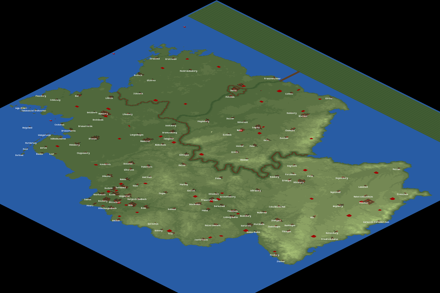
Imagine Germany was an island. This map is based on real heightmap data, and the cities are placed according to their real geographical co-ordinates. The relief on the map varies (south more mountainous, north more flat). Unfortunately, due to space constraints the following large cities are missing: Gelsenkirchen, Krefeld, Hagen, Herne, Mülheim, Solingen, Leverkusen, Neuss, Recklinghausen, Bottrop, and Remscheid. Except for those, all of the cities in Germany with more than 100,000 inhabitants are included, plus many more.
We added a mechanism to simulate the separation between West and East Germany until 1989. Water will come flowing in slowly, and the border (simulated by a wall of radio masts and lighthouses) will "open" around 1989. Yes, we know you can easily circumvent the inner German border (by lowering land near the coast to let the water flow in earlier). The game is more interesting if you don't.